


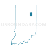
HUNTINGTON 03, Huntington County, Indiana
About
Outline

Summary
| Unique Area Identifier | 577885 |
| Name | HUNTINGTON 03 |
| County | Huntington County |
| State | Indiana |
| Area (square miles) | 0.33 |
| Land Area (square miles) | 0.32 |
| Water Area (square miles) | 0.00 |
| % of Land Area | 99.12 |
| % of Water Area | 0.88 |
| Latitude of the Internal Point | 40.89313210 |
| Longtitude of the Internal Point | -85.49337780 |
Maps


Graphs
Select a template below for downloading or customizing gragh for HUNTINGTON 03, Huntington County, Indiana


Neighbors
Neighoring Voting District (by Name) Neighboring Voting District on the Map
- HUNTINGTON 02, Huntington County, IN
- HUNTINGTON 02A, Huntington County, IN
- HUNTINGTON 04, Huntington County, IN
- HUNTINGTON 11A, Huntington County, IN